

Our project sites, on a live map

Every pin marks a real project, from the 754 km Phokojwe–Kazungula powerline survey to the LiDAR scanning now underway at Lotsane and Gaborone Dams. Filter by category to explore.

LiDAR & Dam Surveys Surveying & Mapping Aerial Photography & Photogrammetry Data Processing & GIS

Pin locations are approximate (town/site level). Satellite imagery from Esri.

Featured Work

Flagship projects

Lotsane & Gaborone Dam LiDAR Surveys

Currently underway: LiDAR scanning and surveying of Lotsane Dam with 30 km of river downstream at Maunatlala, and Gaborone Dam with 25 km downstream.

OngoingLiDARDam Surveying

Phokojwe–Kazungula Powerline Survey

Cadastral and infrastructure survey of the proposed 754 km powerline corridor at 500 m intervals, delivered 2023–2024 for Geoflux.

754 kmCadastralInfrastructure

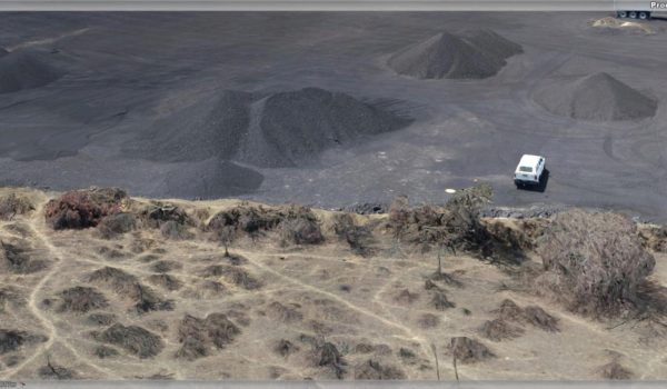
Karowe Mine Aerial Survey

Aerial survey of the full Lucara Karowe mine lease, establishing the aerial control network and levelling 10 benchmarks within the mine pit.

LetlhakaneMiningAerial Controls
From the Field

Real capture, real deliverables

Working Together

Partner stories

A look at the sectors and organisations we partner with across Botswana, from mining houses to property developers.

Water & Energy Infrastructure

Geoflux

Our largest programme of joint work: QA/QC surveying during the Kanye water network emergency works (2023–2024), the 754 km Phokojwe–Kazungula powerline cadastral survey, 100+ km of pipeline corridor topographic surveys at Kanye and Moshupa, and reservoir bottom-level surveys.

Mining & Minerals

Lucara Karowe Mine

Survey of aerial controls within the Karowe mine lease, setting and levelling of 10 benchmarks inside the mine pit, and aerial surveying of the full mine lease (subcontracted by GT Geomatics).

Engineering & Events

Champs Botswana

The BUAN AgroVoltaic project, consultation on the 30 km Mathathane–Platjan road project (2023), and survey support for the Toyota Desert Race (2019).

Master Planning

Urban Heights

Topographic survey of 371 hectares for the master planning of the Botswana University of Agriculture and Natural Resources (2022–2023).

Environmental Consulting

Envirosolve

Topographic survey of the proposed Gamodubu pipeline: a 5 km route on a 200 m wide corridor, feeding route design and environmental assessment.

Conservation & Tourism

Wild African Safaris

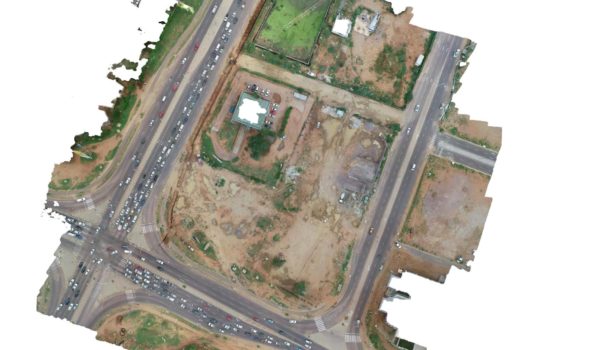
Orthophoto ranch mapping across 1,300 hectares, giving planners a current, accurate aerial base for land-use decisions.

Trail Surveys Drone data processing and CAD drafting across the Morupule area and several road designs, plus a 700 Ha topographic survey at the Gantsi SEZA site and the 35 km Somelo realignment pipeline. Stet Surveying Cadastral survey of 279 plots in Serowe–Tshikinyega, 2023. Geosurv A 350 Ha topographic survey of the Lobatse Special Economic Zone, plus a 10 Ha survey for the Shakawe solar power site. Asphalt Aerial surveys of the Seherelela, Sesung and Sese borrow pits, plus the 72.57 km Kanye Junction to Jwaneng roundabout road contract. J.S Planning Orthophoto mapping for planning at Manong Lodge (15 Ha) and farm properties at Otse (40 Ha). Integrated Engineers Topographic survey of LLR Plot 64260, 2023. Ministry of Health Geotechnical surveys at the Matlhaku Lekganyane and Maruapula clinics, ahead of staff housing development.

Want your project on this map next?

Share your site location and scope. We’ll recommend the right combination of services.